Navigating Your Land Purchase: The Importance of Mapping Tools

In the realm of real estate, buying land is a significant investment that requires careful consideration and planning. Whether you're looking to build your dream home, invest in vacant land, start a business, or invest in agricultural ventures, the importance of mapping tools cannot be overstated. These powerful tools provide invaluable insights and information that can help you make informed decisions and navigate the complexities of land acquisition with confidence.
Understanding the Terrain
One of the primary benefits of mapping tools is their ability to provide detailed information about the terrain of a potential land parcel. From elevation data to slope analysis, mapping tools can give you a clear picture of the topography of the land. This information is crucial for assessing factors such as drainage, flood risk, and suitability for construction or agriculture. By understanding the lay of the land, you can identify potential challenges and opportunities before making a purchase decision.
Exploring Boundaries and Property Lines
Mapping tools are also essential for determining property boundaries and delineating land parcels accurately. With tools like GPS technology and satellite imagery, you can precisely identify the boundaries of a property and verify its size and dimensions. This is crucial for ensuring that you are purchasing the correct parcel of land and avoiding potential boundary disputes in the future. Additionally, mapping tools can help you assess neighboring properties and understand their proximity to your own land, providing valuable context for your purchase.
Assessing Environmental Factors
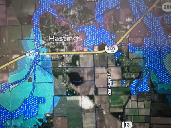
Another key aspect of land acquisition is understanding the environmental factors that may impact the property. Mapping tools can provide valuable information about natural features such as water bodies, wetlands, and vegetation cover. This information is essential for assessing the ecological value of the land and identifying potential conservation or preservation opportunities. Additionally, mapping tools can help you evaluate environmental risks such as flood zones, erosion, and soil quality, allowing you to make informed decisions about the suitability of the land for your intended use.
Planning for Development and Land Use
Mapping tools play a crucial role in the planning and development process, helping you visualize and conceptualize potential projects on the land. Whether you're planning to build a home, develop a commercial property, or establish agricultural operations, mapping tools can help you design and layout your project with precision. By overlaying zoning regulations, land use restrictions, and other relevant data on top of the map, you can ensure compliance with local regulations and optimize the use of the land for your specific needs.
In conclusion, mapping tools are indispensable tools for anyone involved in the process of buying land. From understanding the terrain and exploring boundaries to assessing environmental factors and planning for development, these tools provide invaluable insights that can inform and guide your decision-making process. Personally, I like using mapID and onX, but there are many other mapping programs that provide a variety of layers, including soils, FEMA flood zones, wetlands, private/government lands, etc. As valauble as these mapping tools are, please be aware they are in no way designed to replace a survey or a wetlands deliniation. Look for professional surveyors and wetlands scientists in our professional section or search the internet.


Categories
Recent Posts

"Molly's job is to find and attract mastery-based agents to the office, protect the culture, and make sure everyone is happy! "


